Infrastructure in the Canadian Arctic is being affected by climate change impacts such as permafrost thaw, coastal erosion, and changing temperatures and precipitation patterns. With this in mind, the Standards Council of Canada established the Northern Infrastructure Standardization Initiative
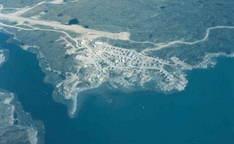
The name Kugaaruk means “a river flowing through a community used for fishing and to supply water.” Formerly known as Pelly Bay, Kugaaruk is located on the Simpson Peninsula, south of the Gulf of Boothia, and is home to some 833 people. As the name suggests, the area is known for its excellent fishing.
Kugaaruk is nestled within coastal mountains, which lie between the bay and the wide expanse of the tundra. As a result, the area is very picturesque. A stone church built by missionary priest been maintained by the Hamlet of Kugaaruk.
The Netsilingmiut, or the people of the seal, are traditional people who have occupied this isolated area for centuries and have only recently (since the construction of the DEW line site in the 1950s) had regular contact with the outside world.